
Place Fell & Ullswater Shore Walk
A beautifully varied fell walk combining a classic summit with a scenic return along Ullswater’s shoreline.
Route Info:
7.8 miles (12.7km) | Moderate / Strenuous | 550m ascent / descent | allow 4-5hrs
Start: Patterdale
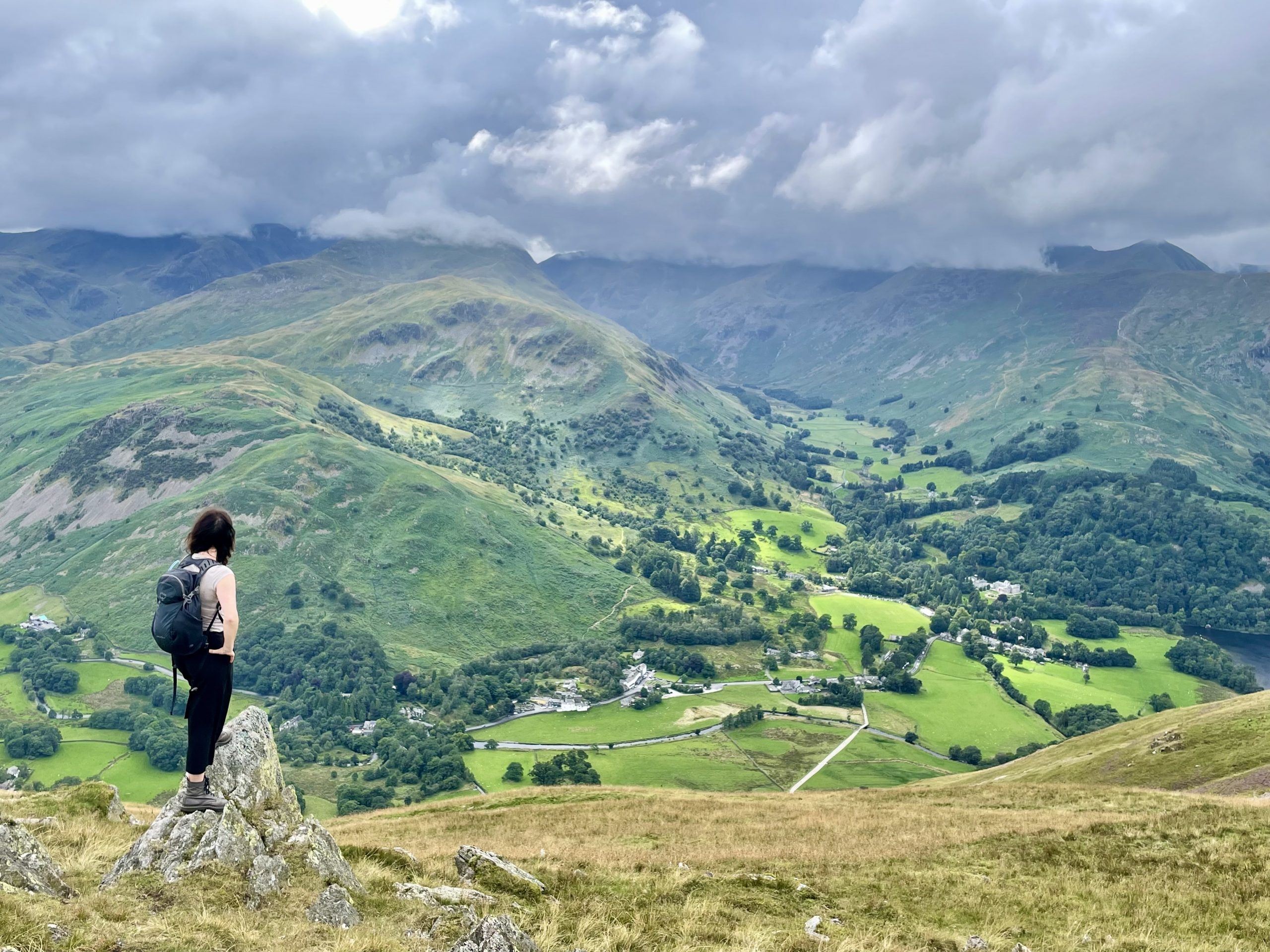
Starting from Patterdale at the southern end of Ullswater, this superb circuit climbs one of the most beautifully positioned fells in the Lake District. Although lower than many surrounding summits, Place Fell offers magnificent views along the full length of the lake and across to the Helvellyn range. After an energetic – and, at times, relentless – ascent, you are rewarded with stunning panoramas, and the continuation along the ridge beyond the summit, then an undulating return above and along the shoreline, make this a particularly varied and enjoyable outing.
Highlights
Open this map on Komoot
Route description
Safety & practical information
Terrain: Fell paths with some steep sections on the ascent and descent. The ridge beyond the summit is exposed in places but follows clear paths throughout.
What to take: Map (OS OL5 – English Lakes NE), compass, waterproof clothing, warm layers, sturdy walking boots and sufficient food and water. A headtorch and basic first-aid kit are also recommended.
Other info: Although the paths are generally clear, mist and cloud can make navigation more challenging on the summit plateau. Check the weather forecast before setting out and allow sufficient time to complete the walk comfortably.
Start: Patterdale
Starting from Patterdale at the southern end of Ullswater, this superb circuit climbs one of the most beautifully positioned fells in the Lake District. Although lower than many surrounding summits, Place Fell offers magnificent views along the full length of the lake and across to the Helvellyn range. After an energetic – and, at times, relentless – ascent, you are rewarded with stunning panoramas, and the continuation along the ridge beyond the summit, then an undulating return above and along the shoreline, make this a particularly varied and enjoyable outing.
Highlights
- Magnificent views over Ullswater and the Helvellyn range
- A classic Wainwright summit (657 m)
- An enjoyable yomp along the summit plateau
- Scenic lakeshore return to Patterdale
- Divert to Silver Bay for a picnic and/or a swim
Open this map on Komoot
Route description
- Start from the car park or bus stop at the Patterdale Hotel. Either walk along the road past the White Lion Inn before turning left over a bridge, or take the footpath behind the hotel which leads through woodland to the same lane at Rooking.
- At the end of the lane turn right through a gate, cross a small bridge and follow the well-signed path climbing steadily towards Boredale Hause, with increasingly fine views back along Ullswater.
- At Boredale Hause, where several paths meet, turn left (north) and climb the gravel zigzags up the southern flank of Place Fell.
- A short rocky gully near the top leads onto Round How, a superb viewpoint with sweeping views towards the High Street range, Angletarn Pikes and the Helvellyn fells.
- Continue north along the broad ridge to reach the cairn marking the summit of Place Fell (657 m).
- Beyond the summit follow the ridge north-east across open fell, enjoying fine views towards the northern end of Ullswater.
- Pass a sheepfold at Low Moss, then bear left onto a narrower path which descends northwards, skirting the western side of High Dodd.
- Continue descending as the path gradually converges with Scalehow Beck, passing a small disused quarry and building on the way.
- Soon reach a track above the intake wall where you turn left onto the Ullswater Way, following the bridleway along the lakeshore.
- This undulating shoreline path provides a beautiful contrast to the high fell terrain above, with excellent views across the lake.
- Continue along the lakeside path to reach Side Farm, where you turn right through the farmyard to follow the access road over cattle grids and across Goldrill Beck.
- Emerge beside the George Starkey Hut, where a short walk along the road returns you to Patterdale, bringing this fine Ullswater circuit to an end.
Safety & practical information
Terrain: Fell paths with some steep sections on the ascent and descent. The ridge beyond the summit is exposed in places but follows clear paths throughout.
What to take: Map (OS OL5 – English Lakes NE), compass, waterproof clothing, warm layers, sturdy walking boots and sufficient food and water. A headtorch and basic first-aid kit are also recommended.
Other info: Although the paths are generally clear, mist and cloud can make navigation more challenging on the summit plateau. Check the weather forecast before setting out and allow sufficient time to complete the walk comfortably.
Article | Walks